P-Town Playground

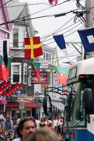


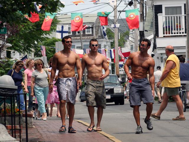


P-Town is one big party that spills out into the street, and I do mean “the” street, Commercial Street, the main street in town. When we exited the ferry, we walked along Commercial, me wheeling our luggage behind me and Clint carrying both backpacks. We were told the hotel was five minutes from the dock. They lied. We walked for at least 10 minutes hauling our overstuffed bags, intermittently asking our friends, breathlessly, “How much further?” I know, for you people who live in a walking city, 10 minutes is nothing. But we live in Dallas, a 10 minute walk seems as daunting to us a trek across the Sahara. The difference in this instance being the animals you cross along the way. Instead of cobras and camels, we saw ripped roid-boys and costumed drag queens walking shoulder to shoulder with straight families (whose kids, by the way, did not even seem to notice the extravaganza playing out before them).
Commercial is a narrow street lined with typical Eastern seaboard, faded wood-framed houses, most of which were converted long ago to restaurants and t-shirt shops. But even with the commercialism apropos of it name, Provincetown’s main street still holds its old charm, from the clock tower of the Townhall to the long, narrow architecture of its waterside structures, it doesn’t take much imagination to place yourself back 200 years ago in this town at the end of the Cape.
On the Townhall grounds, there is an arched granite wall about 20 feet long and 4 feet tall. It is a memorial to the war dead of Provincetown. The wall has four square panels about 3 feet by 3 feet. The first two are dedicated to WWII the third to the Koean War and the fourth has “Vietnam” at its top center, but then to the right, along the edge, they’ve squeezed in a heading that reads, “Pnanma-Greneda-Haiti-Gulf-Bosnia-Somalia-Lebanon.” At first, when I saw that all the panels were full, I thought, “How niave and sad. They never dreamed we’d have so many battles in so few years.” Then I thought how sad that they don’t even have room for the latest war—Iraq. I guess they’ll build another, and another.” Will we ever learn?
Jeff and Ed walked to the top of the Pilgrim Tower this morning. It is a granite cut block structure built in 1907 to commemorate the landing of the Pilgrims. The tower rises thin and tall fom its 30 foot by 30 foot square base 150 feet into the air. Climbing the ramps on the inside turn corner by corner by corner, the only distractions are the few rectangular windows cut in the 3 foot thick walls give glimpses of the scenes belw, and intermitant placards or corner stones giving the names of various Massachusetts towns and when they were incorporated. Each placard was approximately 2 feet by 2 feet most with just the name of the town and a date like Boston 1648. But several had the original name of the city and a date, followed by “named changed to ______” and another date. One marker read, “Falls River 1640, name changed to _________, 1800, name changed back to Falls River 1832.” It made me wonder what was going on back then that led so many town to change their names, and in particular, what was happening in Falls river that made it change its name, then change it back, all in the span of 30 years. It all semed like such a waist.
As they made our way back down the tower ramps, which seems to take longer than going up, we came across a place that read, Swampscott, 1630. I turned to Jeff and said, “Swampscott? What kind of a name is Swampscott? Of all that towns that should have changed its name, that was the one.”
posted by Clint Thomson @ 7/02/2005 03:15:00 PM
![]()
![]()


<< Home